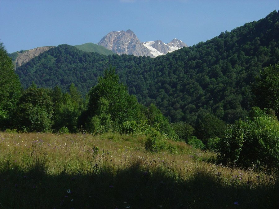
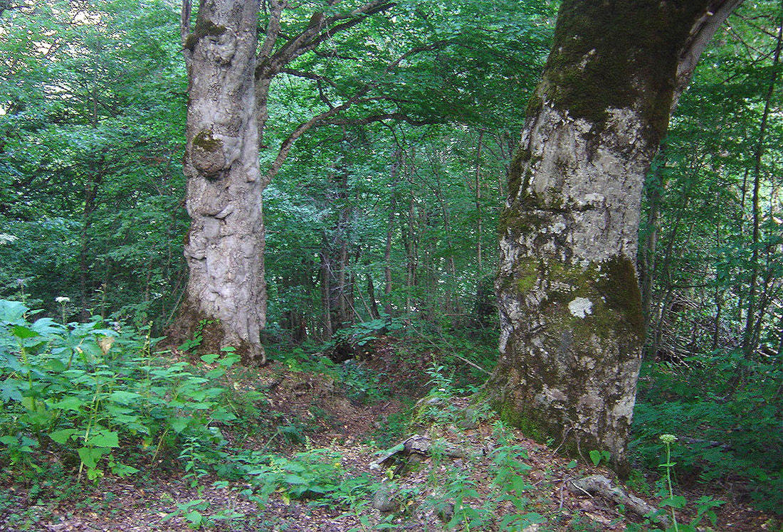
 First recorded in Hesiod's Theogony (c. 700 BC), Pasis is an ancient Greek name of Rioni, one of the great rivers of the Caucasus with it's source in the glaciers of mountain region of Racha. Racha is a seldom visited place. However, it wasn't always so. During the Soviet era there was a well-known resort in Shovi, the place rich with mineral springs and attractive because of it's mild climate. Geologists explored the rich deposits of ore in Zophitura valley. Moreover, there were tourist groups (although not as numerous as in Abhazia) who crossed the popular Gebivtsek and Gurjivtsek passes. After collapse of USSR Racha has sunk into oblivion. Map from 1718. Poti of today was Pasis, Kutaisi was Cotais and Svans (Soanes) lived on the other side of the Caucasus Range. This map clearly shows how little known Georgia was . 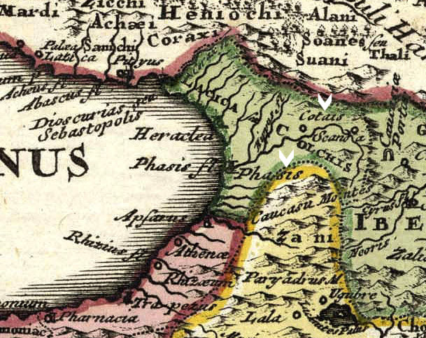 Many years passed since I visited there and only in summer of 2015 I have decided to return. Join me for this short yet spectacular trip! Starting point was Didube bus station in Tbilisi. Bus left at 8 AM and only in the late hours of afternoon I arrived to Oni. Road, in particular it's part above Tkibuli, was very beautiful. After crossing Nakerala Pass and seeing blue waters of Shaori with high snow peaks on the horizon I felt a strong heartbeat in anticipation of getting into this magnificent place. Shaori reservoir and snow peaks of Caucasus Main Range 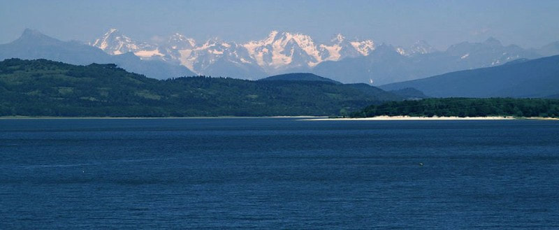 Oni is a village but it's paved lanes with street lamps, spacious central square with large hotel and a massive building of synagogue might be misleading. Is it actually a small town? But after a while you realize that it is certainly a village though large and well planned. Synagogue of Oni with Mt. Shoda (3605m) in the background 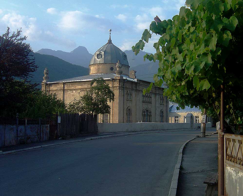 Today you almost won't find any Jews in Oni but once there was a well-integrated community of more than 600. In 1970-1990 they all left for Israel but occasionally old people come to visit (photo below). Their inborn link to Racha is still very strong. Abandoned jewish houses and overgrown cemetry on the outskirts of Oni look rather sad. Jews of Oni, once and today 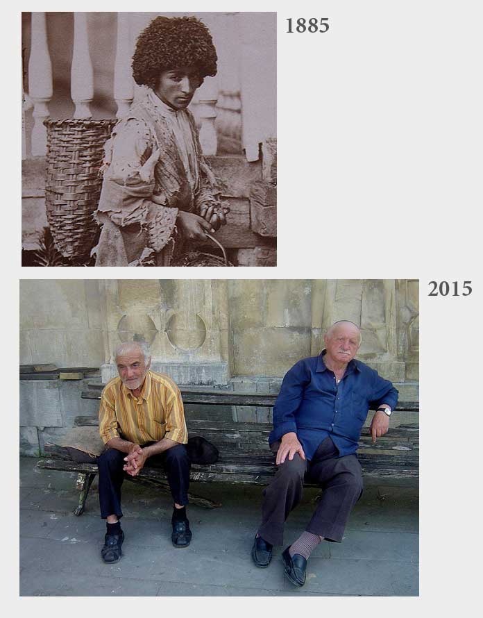 I carried on to the main village of High Racha, Gebi. Few people know that once it was part of Svaneti and there were numerous towers which unfortunately didn't survive. Towers or not, this is a very attractive place set amid some truly magnificent mountains... 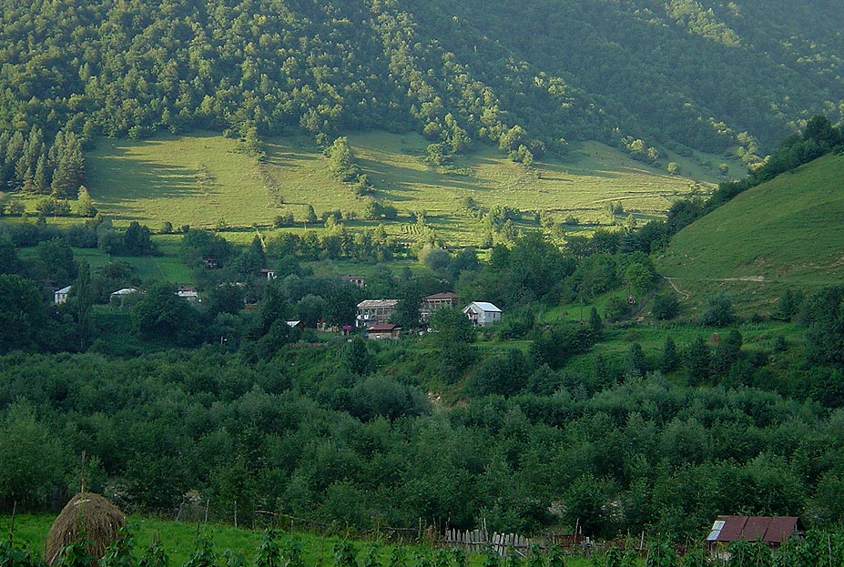 Those days in August 2015 were extremely hot and local men (women had a separate spot elsewhere) took a refreshing bath in a small pool dug by bulldhozer in a wide river bed of Rioni, just outside of Gebi. I took a deep breath and plunged following others into a freezing mountain water. It was invigorating and made my next hours of walking considerably easier. 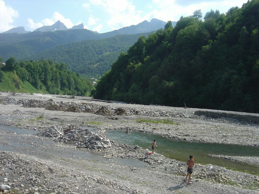 Three man from Border Control met me in Shiukachala (6 km from Gebi) a small place with few summer houses further up from the Zophitura iron bridge. They told me that the group from "czekoslovakia" (in Georgia many people still use this name) went ahead of me and there is still 2,5-3 hours walk to Rioni Refuge. Road between Gebi and Shiukachala 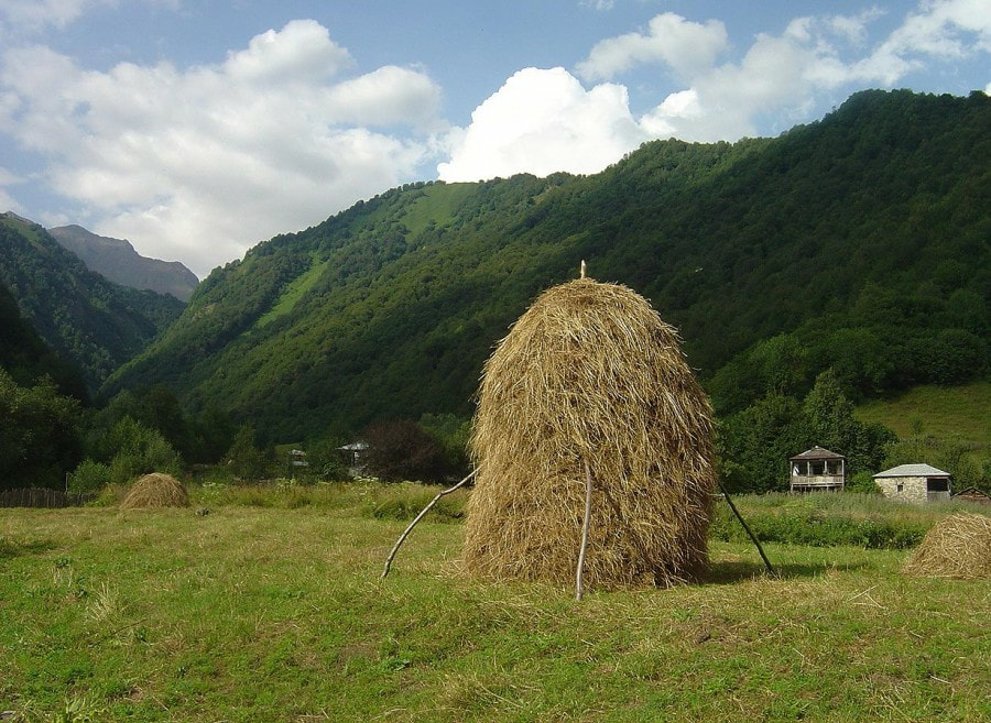 So I decided to camp and to start early in the morning. Pitched my tent next to the Border Control station which is no more than the simple house they use for sleep and rest. Was presented with loaf of bread and matsoni (Georgian variety of yogurt), invited to come over for "talk". 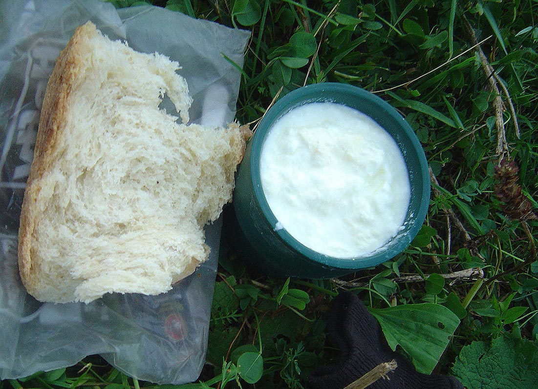 Which I did after darkness fell and when there was not much else to do. With single candle and their uninterrupted cigarette smoke the conversation went smoothly from one subject to another. These man were simple and true to themselves. My tent and Tsihvarga (4180m) imersed in a blue colour of dusk. 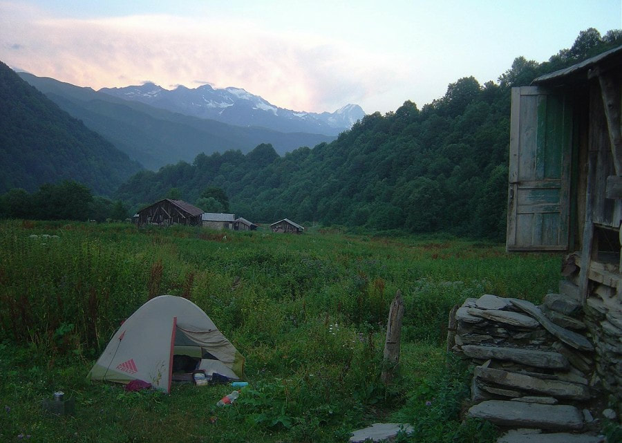 Morning was clear and warm. Soon I was back on the trail which soon, after crossing the wide rocky bed of black slate, brought me to spacious sun-drenched meadows. Then it took me further; through the shady carpinus woods, across numerous streams and meadows full of cricket's chirps. The day was hot and to walk on meadows was quite exhausting. Thank you, tree! Here is much cooler. 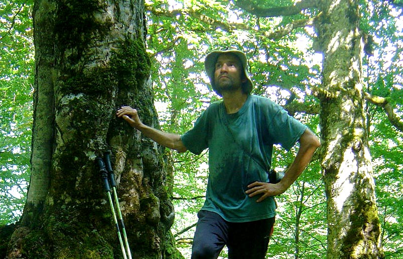 This trail runs along the high bank of Rioni, is quite level and easy (apart from spot where high banks of a side stream had to be negotiated). In June-July when there are more rains (and floods) and grass is taller this route may become a challenge. Ahead, all the way to Sasvano Lakes was clearly visible. 1. Sasvano lakes 2. pass to Svaneti 3. Pasismta (3856m) 4. Gezevtsek Pass (to Russia) 5. Edenamta (3800m) 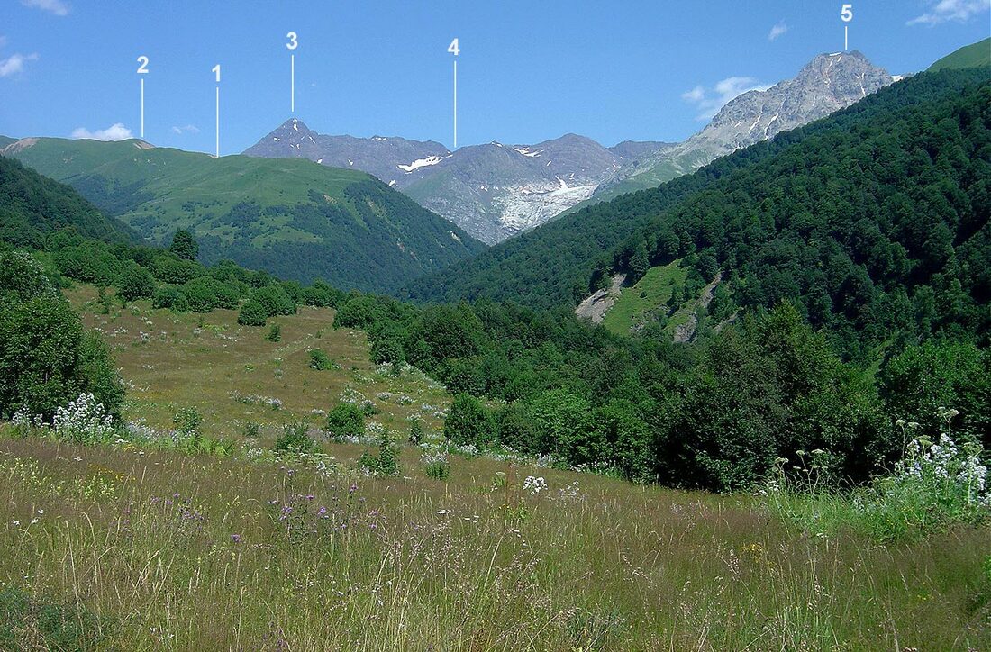 At 14:00 after crossing still another creek I entered a wide meadow. To the left, amid tall weeds I could recognize the stone structure of Gezevtsek Refuge. Tried to break through this thick and thorny wall but in vain... Returned back to trail. Supposed to be some way to access it, right? Gezevtsek Refuge (right) and pass (not used anymore) to Lukhuni valley 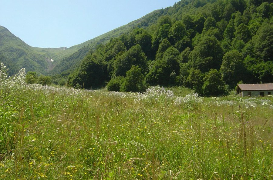 Eventually after a brief search I found that there was a path leading to refuge from the right hand side through the backyard. Steel and rusty roof still covered one room making it livable. Interior was spartan: roughly made wooden "bed" covered with hay and wool blankets, fireplace with some pots and writings on the wall gave a clue about the former guests of this unassuming place. To the credit - this place was clean. Once this refuge was used (when the border with Russia didn't exist) by hikers who joined government subsidized trekking groups across the passes of Main Caucasus. Those huts were of very decent quality but didn't survive the last decade of 20th century. 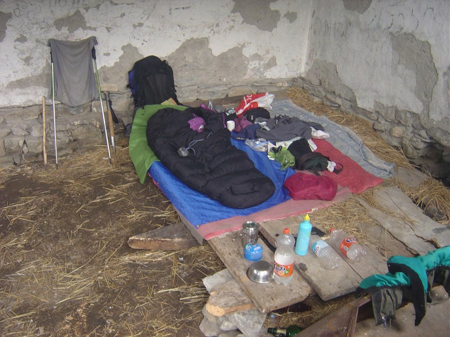 So now I was facing a dilemma - should I stay here or move forward and camp at Sasvano Lakes? It was cool inside and I had no desire to leave it for a blazing sun outside. It is important to mention that the air on the southern slopes of Main Caucasus is typically heavy with flower fragrance and on a hot day this is not a blessing as you might think... I decided to stay. Unpacked, made things inside more homey and relaxed while reading a book ("Hadji Murat" by Tolstoy). In couple of hours it became obvious that my decision to stay was completely justified. At first sky turned dim and minutes later some heavy drops heralded the coming rain that started a noisy drum beat on a steel roof of the refuge. If I would go to lakes I would be completely soaked. That's for sure! I started to appreciate this refuge even more! The night was cool and I realized that the weather will be clear and sunny. On the other hand the forecast for coming days wasn't too promising. Line of ascent from the refuge to Sasvano Lakes 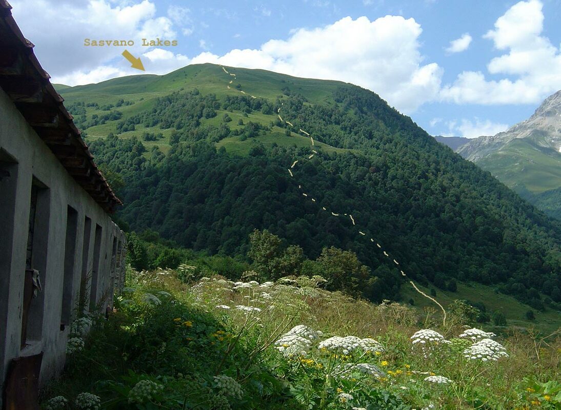 In the morning I decided to leave my backpack at the refuge and go light. Needles to say - I was dripping wet after only few minutes walk in tall grass. Noticed a few exceptionally tall species of Herculaneum, it's name is apt as it grows to some fearsome height of 3-4 metres. 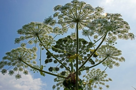 Don't ever touch it, especially on sunny day. You won't feel anything at first, but in few days the parts of skin that were in contact with this weed will be badly burned. .. Part 2 will be posted next week I drew this map so you will have better idea of the area 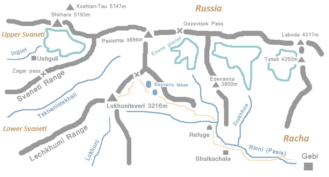
0 Comments
 Overgrown and ruined road to Sasvano Lakes After crossing Sasvano creek and overgrown meadow the trail turned west and climbed steeply amid the trees. Higher up I noticed some traces of an old road. There were white-red marks every 300m or so. 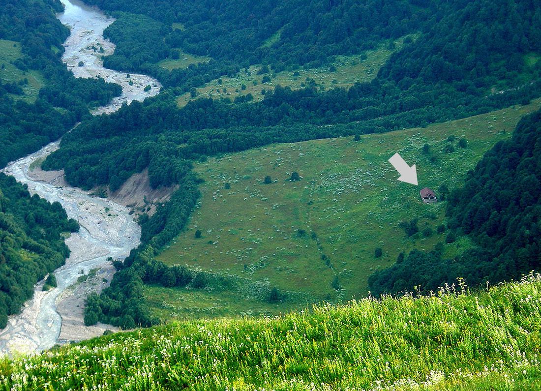 Later on upon leaving a tree-line that already faint trail almost disappeared in thick grass. The Refuge and the river came into view (photo above). After a while, on the ridge, it appeared again bringing me to the first and smaller lake. It's waters were muddy and I couldn't not spot any appropriate place for camping. Tall grass was everywhere. 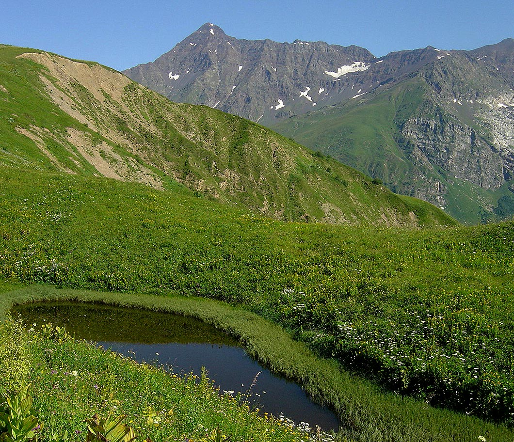 Soon I arrived to the second lake. Grass there was thinner and there were plenty of spots for camping. Lechkhumi range was already close and it took me another 30 minutes to get there. 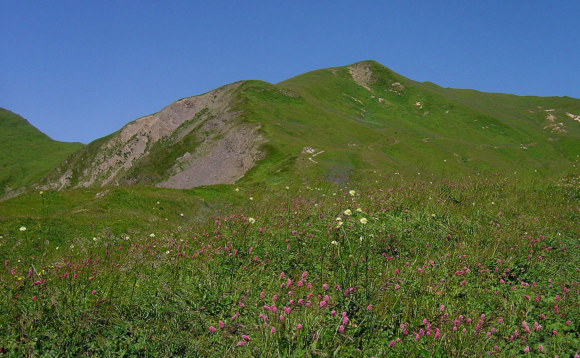 Beautiful sunny day, refreshing wind and magnificent views into Tskheniskhali valley (translated as horse water). Even Ushba was visible in a haze of a distant horizon... 1. Tetnuld 2. Ushba 3. Dadiashi 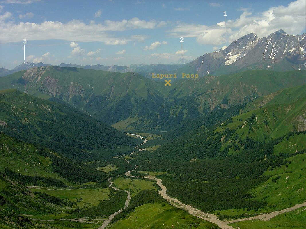 Looking north I was attracted by magnificent West Edena glacier whose three sharp tongues hanged on the rocky face of Geze-Tau (4008m). The main glacier was a typical valley glacier and it's ice and snow gave birth to Rioni. 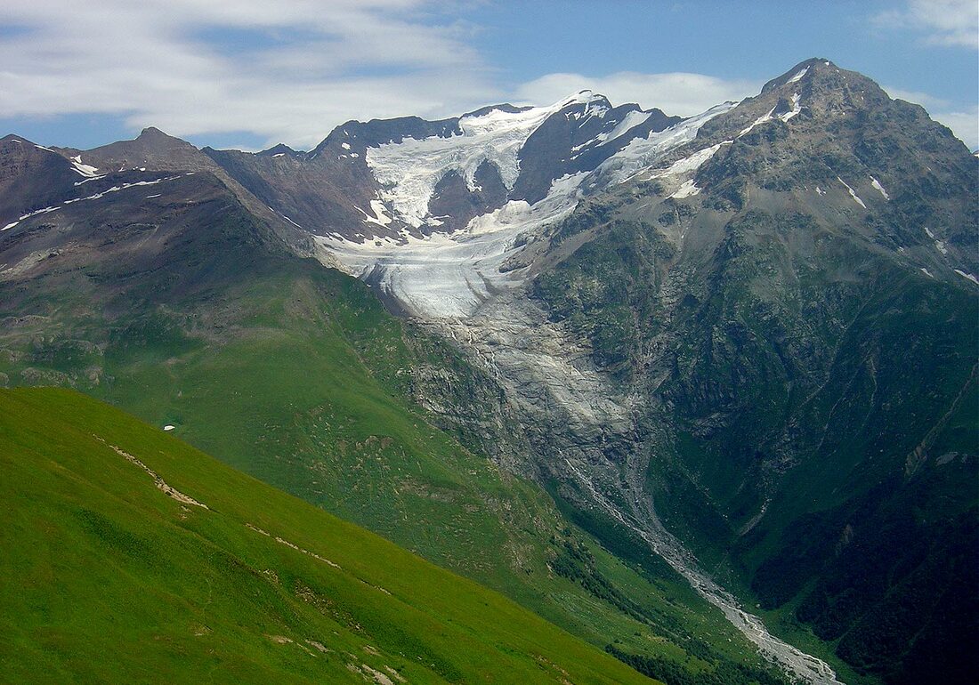 Looking south and above I could see a long ridge leading to the summit of Lukhunistsveri (3216m). This whole landscape reminded me of Scotish Hills. And so up I went. 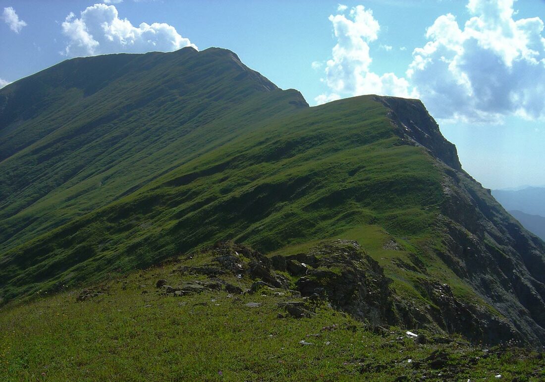 It's east side above Sasvano gorge is not steep, the west side is broken and precipitous One hump led to another which seemed to be the last one. Not at all! In the foreground is the ridge of Lukhunistsveri , in the background are the peaks of the Main Caucasus Range. 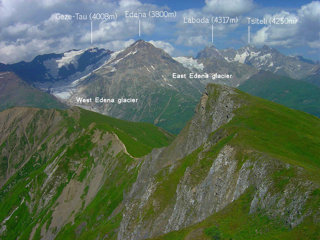 After 2,5 hours of ascent I finally reached the flat and wide top of Luhunistveri. The view was sublime. Tskheniskali and Rioni valleys merged into the distant horizon. High peaks of Racha were perfectly visible. Behind them is Karaugom Plateau which is among the largest in the Caucasus. 1. Tsihvarga (4138m) 2. Burdzhula (4357m) 3. Karaugom (4347m) 4. Uilpata (4638m) 5. Double-Peak (4350m) 6. Bubis (4468m) 7. Chanchakhi (4450m) 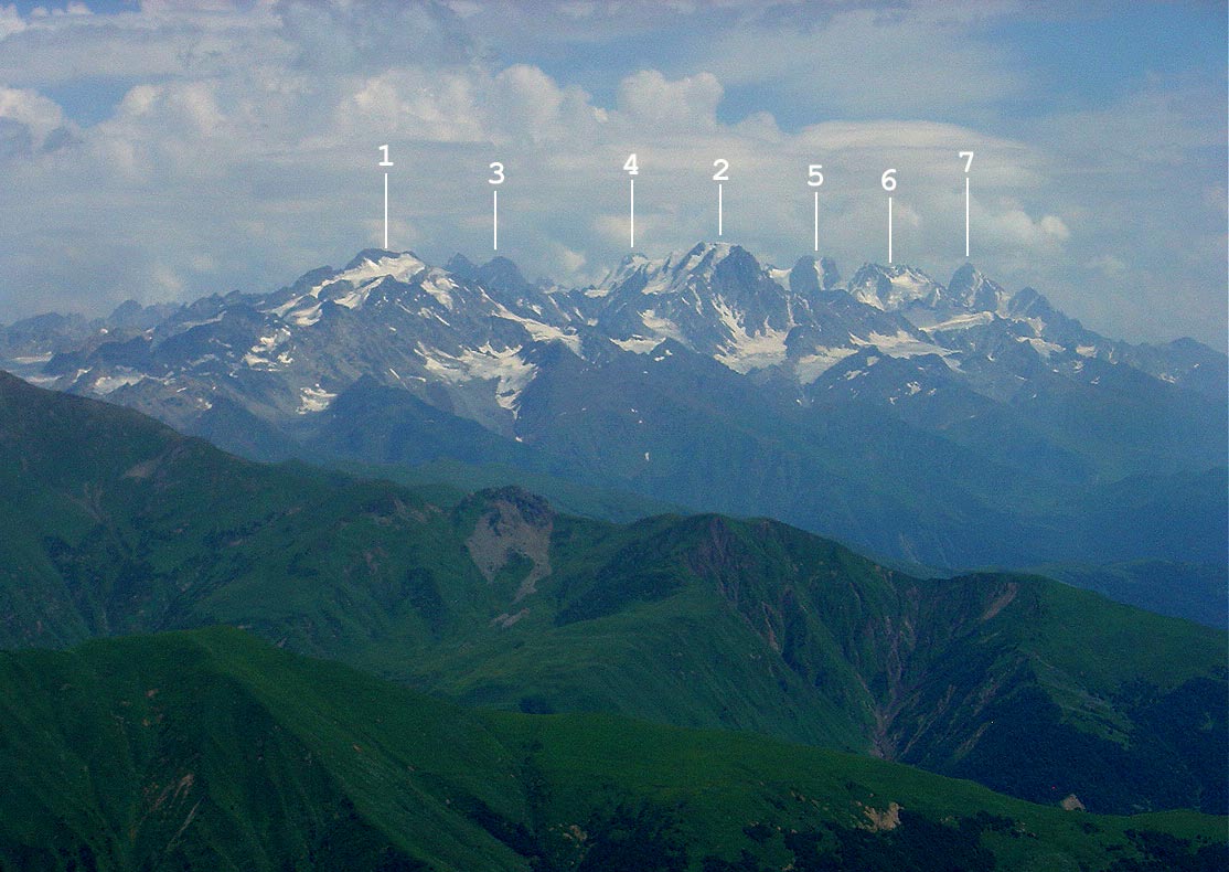 East view with Rioni valley. In the center are those folded mountains known mainly because of Udziro Lake, in the right - Mount Shoda (3607m). 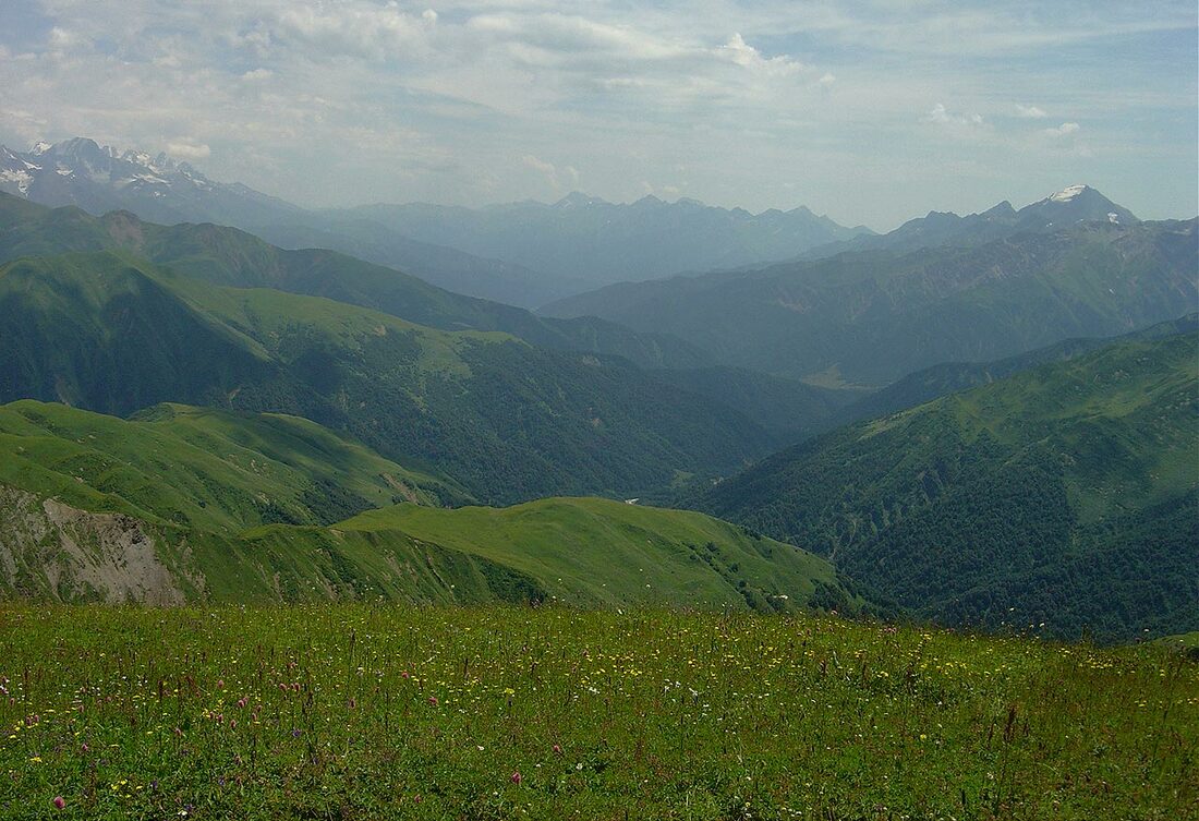 Spent almost two hours on the summit and during that time weather started to change. Svaneti horizon turned misty and wind started to blow. Time to climb down... Upper Sasvano Lake  At 8 PM returned to my "residence" and just in time. Heavy rain started almost immediately and continued all night long. 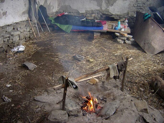 Morning was cloudy and rainy. I walked back to Gebi. It was much easier because of cooler weather but fording those side streams was quite unpleasant. On sunny days their surface was hard and consolidated clay which after rainy night turned into a deep mud. With heavy backpack it wasn't fun at all... River bed of Rioni unrecognizable after heavy rains 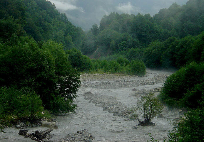 Came to Shiukachala in 2 hours and was invited by a local man who stay there with his old parents. Cheese, bread, matsoni and Saperavi were put on table and proved again that hospitality comes naturally to this hardworking people. 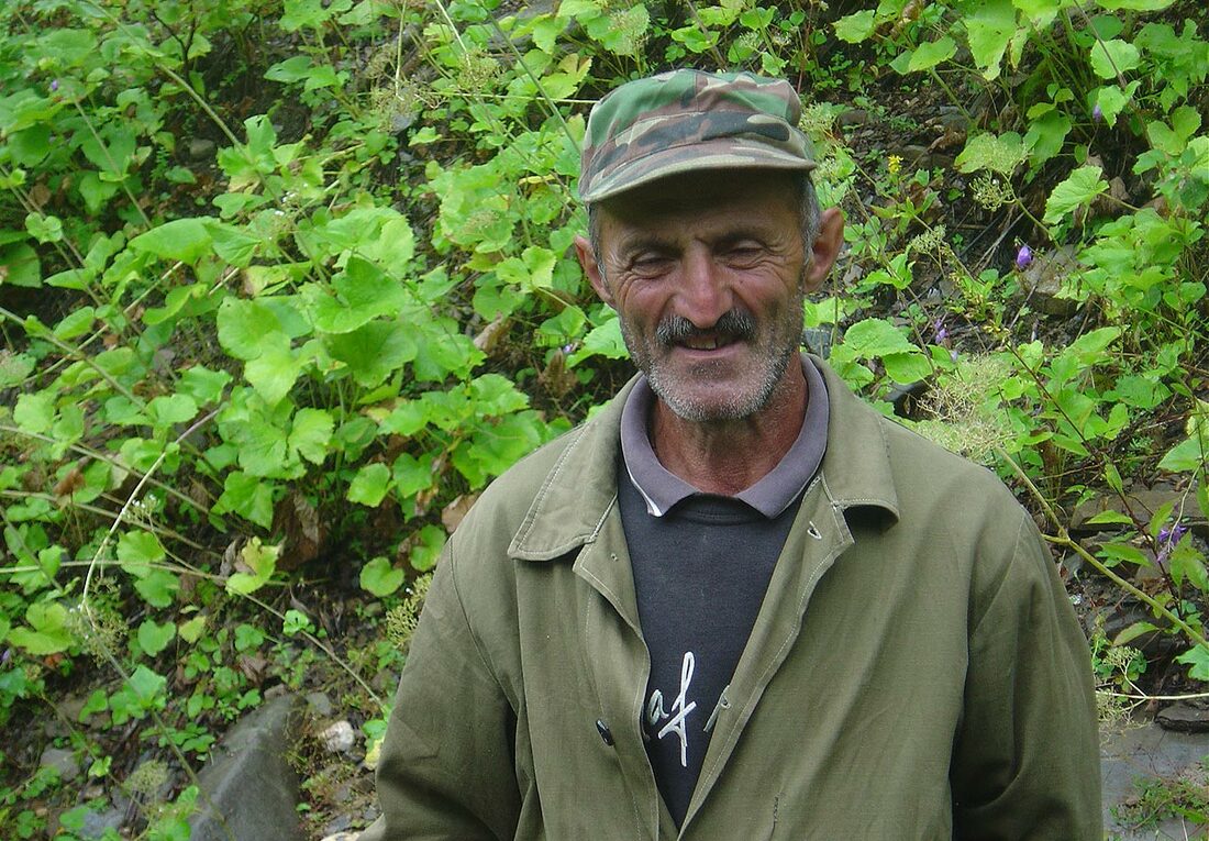 And few hours later while I was approaching Gebi this same man shouted across the river: " Wait near the school building and at 6 the bus will come!" And so it was. 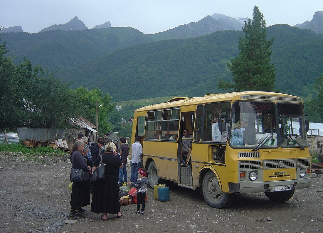 In Oni, again! Spent the night at the house of Nino and Yuriy. In the evening I was treated by delicious meal at the guesthouse "Gallery". And the next day, by late hours of afternoon I was back in Tbilisi. Hot, crowded and noisy. 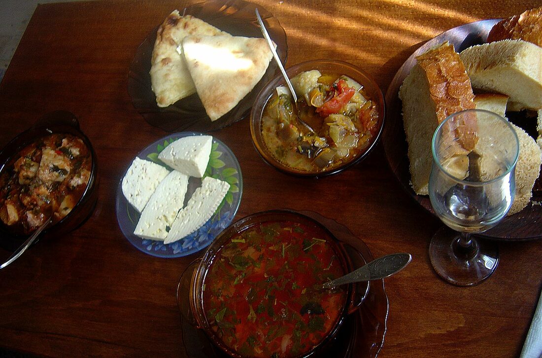 Map of the route. Gebi > Shiukachala > Sasvano lakes > Lechkhumi Range > Mt. Lukhunistsveri  |
 RSS Feed