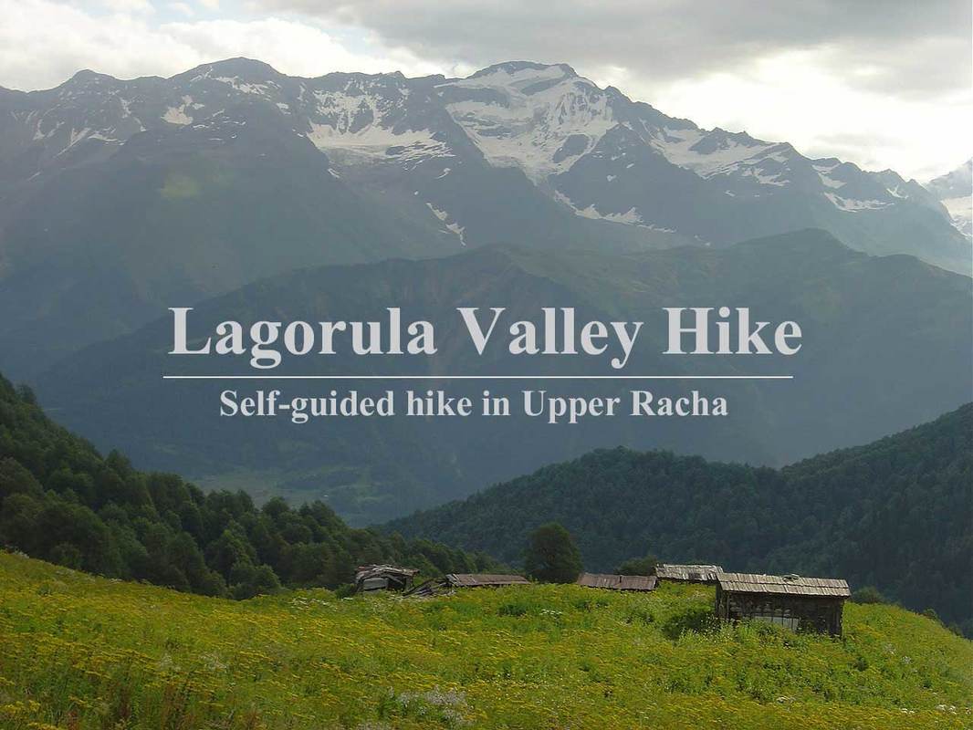
 This one day hike from Ghebi to the valley of Lagorula is interesting for many reasons. The views of sheer walls of Lagora massif, a walk through the shady carpinus woods and splendid panorama of Caucasus Main Range peaks. And there are more. There is an option to cross Lagora range and descend all the way to Utsera. This route is quite difficult but passable and takes 2-3 days. Here is the description of Ghebi-Shoda Base Camp section of this route only. As a day hike from Ghebi it is highly recommended. For easier and shorter walk just hike to the church (or huts). Height Gain: 900m Hiking Time: 8-9 hours Start: Patara Gebhi 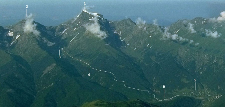 1. Mt.Shoda (3609m) 2. Mt.Lagora (3109m) 3. Shoda Base Camp 4. Church of St.George 6. Magti cell towers 5. Patara Ghebi village 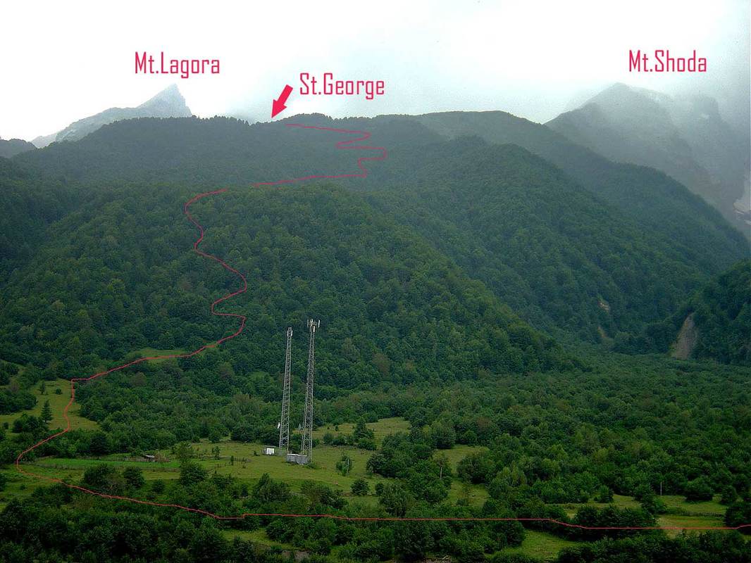 Cross the bridge to Patara (Small) Ghebi and walk east through the village, then across few streams until you reach Magti (mobile service) towers. 30 min. from the bridge. Here it is important to find the road and this task might take a while. Follow a low stone wall (photo below), then through the line of trees to another meadow 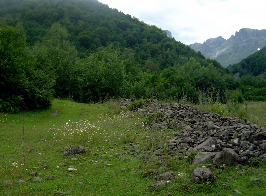 Turn slightly right (south) and climb to the second meadow. On it's right hand edge there is a muddy trail (south-west) amid the trees. After 300-400m it will bring you to the road which is half hidden under the trees. This road serves locals who walk from Ghebi to the church of St.George. After few switchbacks it almost disappears, but the direction is obvious. There are some small ravines so walk along it's ridgelines. Then a more level ground surrounded by carpinus trees of extraordinary shapes. 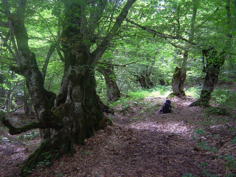 After 40 min you will cross a small creek. Follow the trail that climbs along the gully. Entering level ground the trail disappears, but shows again while going through azalea bushes. The direction is south most of the time.The ground is covered by thick carpet of dry leafs and there are occasional muddy spots. Some kind of trail appears again, turns right 45 degrees and in few steep switchbacks (here the trail is wider) will bring you to the ridge (1 hour from creek) with views of snow peaks. After another 15 min you will enter a clearing with church almost hidden by trees on your left. Festivals (Georgoba, Elioba) are celebrated here every year hence are the rain tarp and crudely made tables. Looking south the sharp peaks of Lagora come into view. Below them Lagora Huts are also visible. 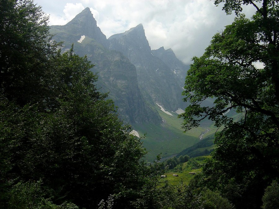 On the opposite side of the valley is Mt.Shoda with it's snow covered top. This is the only glacier of Shoda-Kedela Range. The trail descends to a small creek and after 300m leaves the forest. Beyond this point (already above tree line) there are meadows covered by tall grass. Continue to abandoned and half-ruined huts surrounded by thick walls of stinging nettles. If there is no passage (cut by locals) this might cause you to surrender. Further direction along the slopes above Lagorula is quite obvious but the trail disappears every once in a while. Stream crossings in deep gullies are rather steep. But here you will find traces of the old trail that once was well-beaten (by geologists and locals). Approaching a grass-covered hill you will cross a considerable side stream from Shoda. 1,5-2 hours from the church. 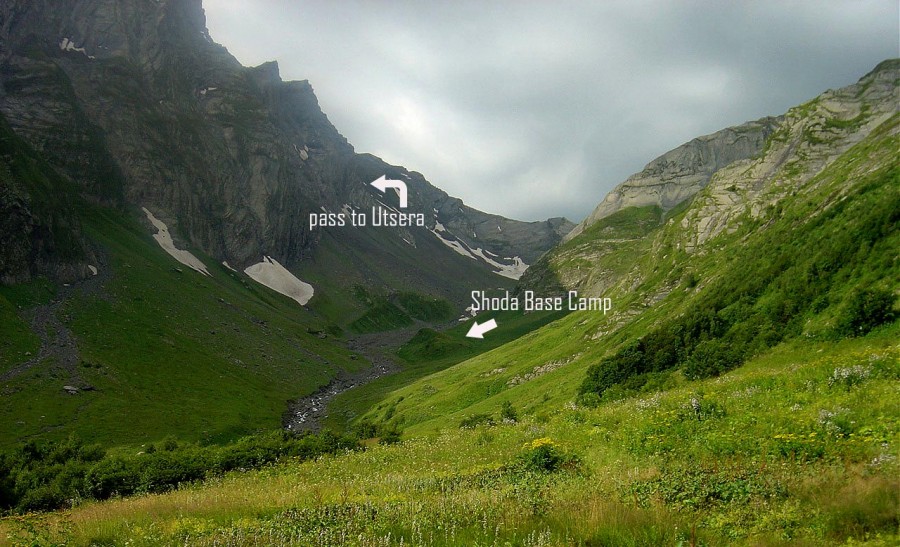 Shoda Base Camp (just a spot that you likely won't even notice) is beyond this hill and if looking north from it's top all the route from the church is visible. Return to Ghebi by the same route 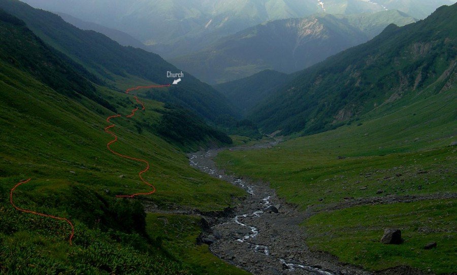
32 Comments
|
 RSS Feed