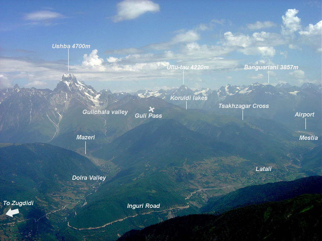
from Mestia - Ushguli trail (80 min after leaving Mestia)
S V A N E T I P A N O R A M A
This page is the only source for panoramic views of Svaneti mountains.
For larger size > right click > open image in new tab.
You may also save them (for personal use only).
For larger size > right click > open image in new tab.
You may also save them (for personal use only).
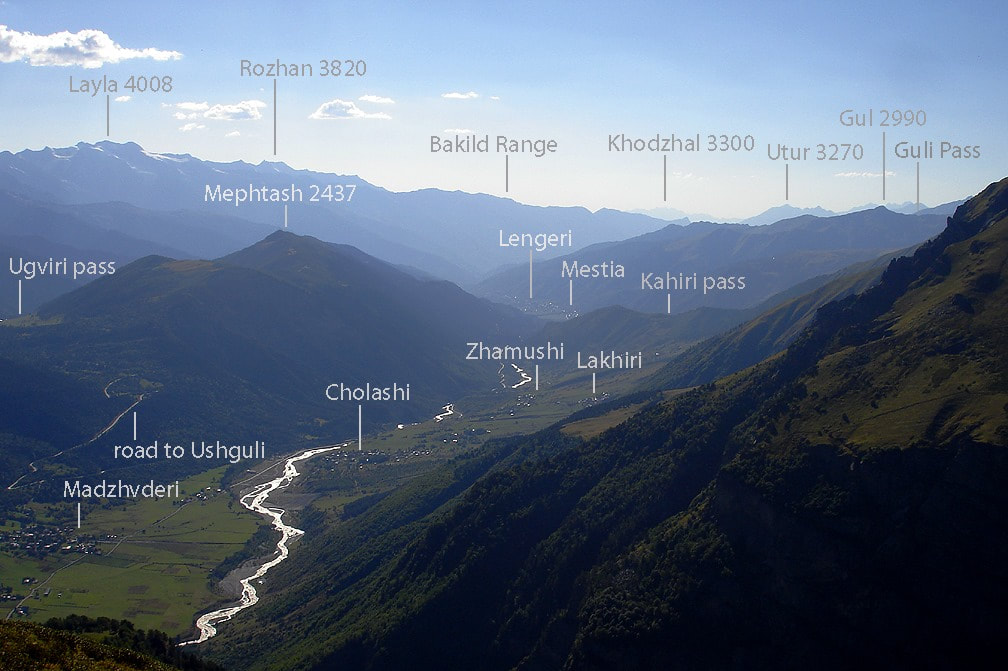
On Mestia-Ushguli trail, from Kakhiri meadows
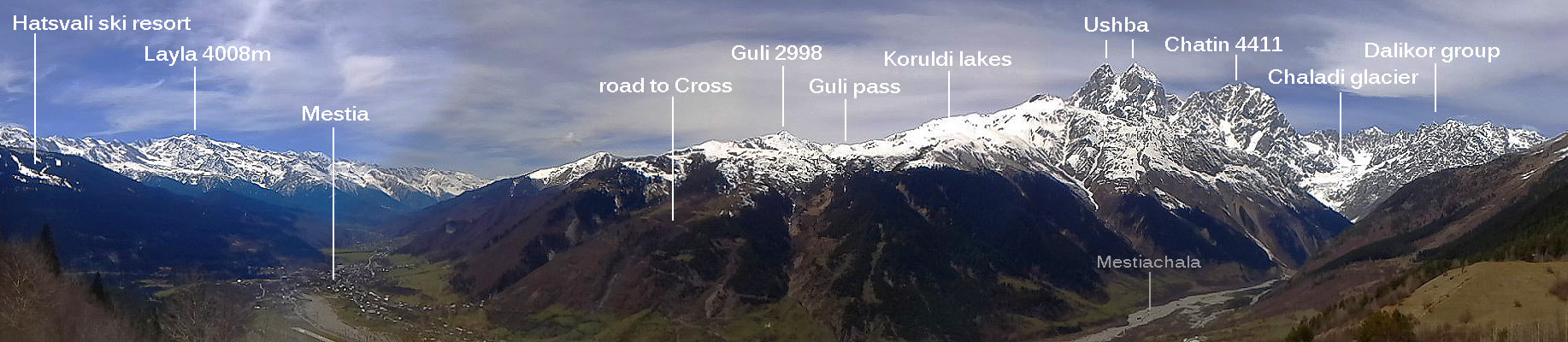
from Hatsvali ski resort
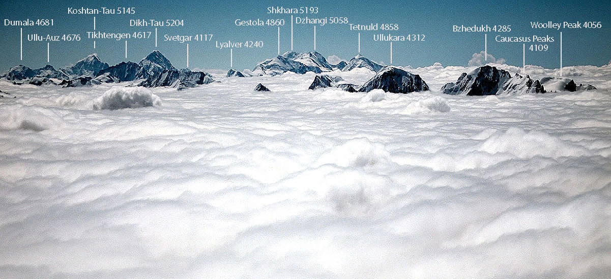
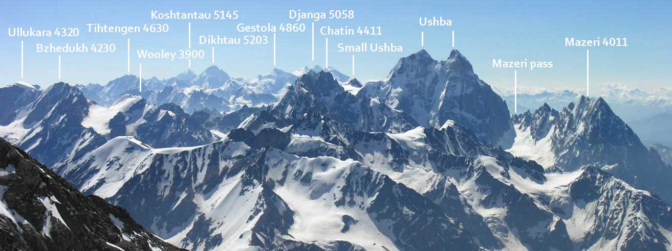
High peaks of Svaneti. View from the summit of Elbrus
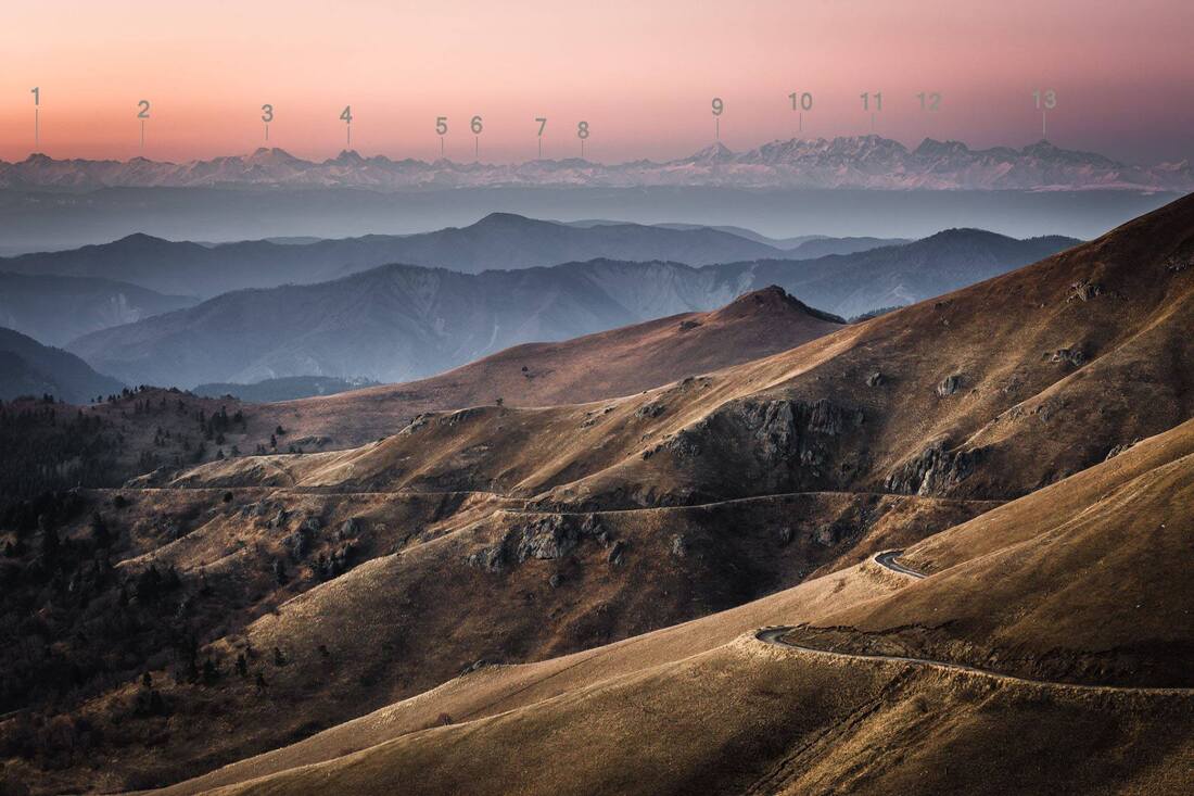
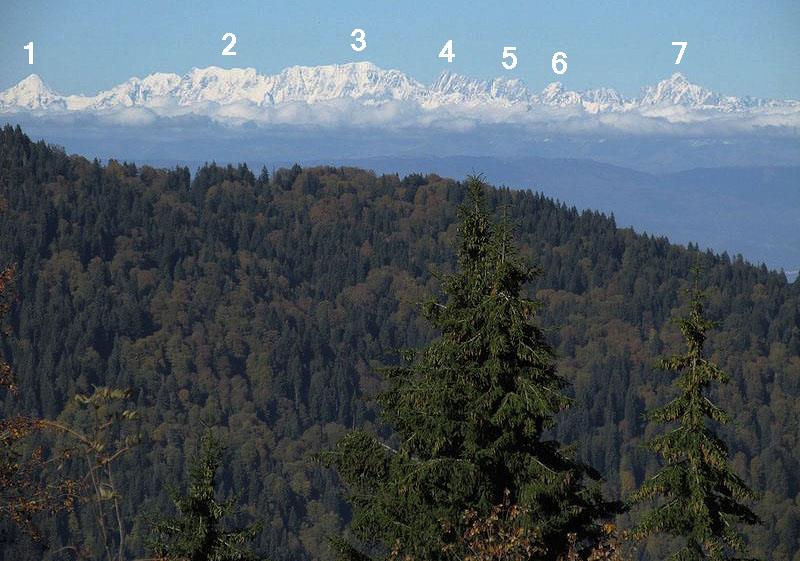
View of the Main Caucasus range from the foothills of Georgia (photo: Thomas van Hemert)
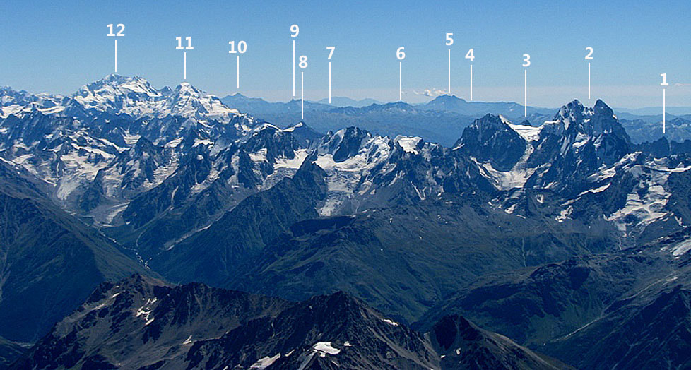
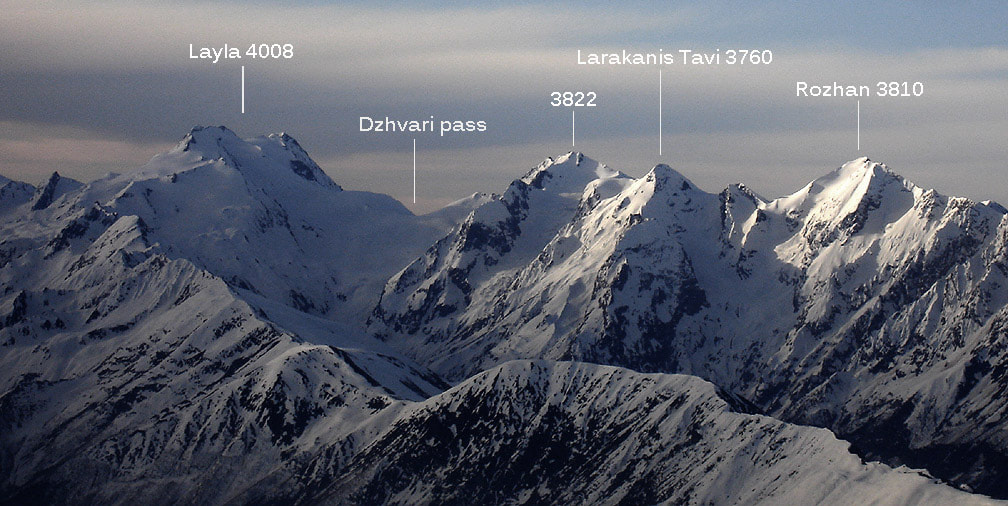
1. Layla (4008m) the highest peak of Svaneti Range
2. Gvadarash (3750m)
3. Elbrus (5642m) - the highest mountain of Europe
4. Ushba (4710m)
5. Ullu-Kara (4310m)
6. Bashkara (4250m)
7. Svetgar (4117m)
8. Tihtengen (4620m)
9. Tetnuld (4835m)
10. Dzhangi (5055m)
11. Shkhara (5193m)
12. Dikh-Tau (5205m) the second highest in Europe
13. Koshtan-Tau (5145m)
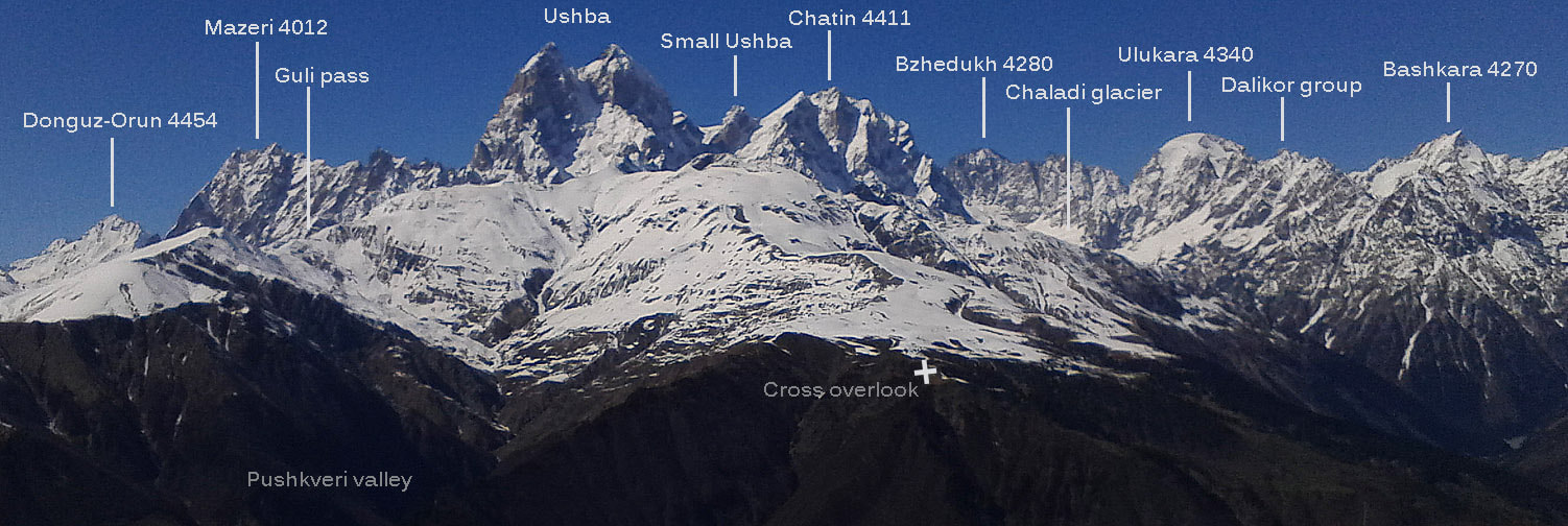
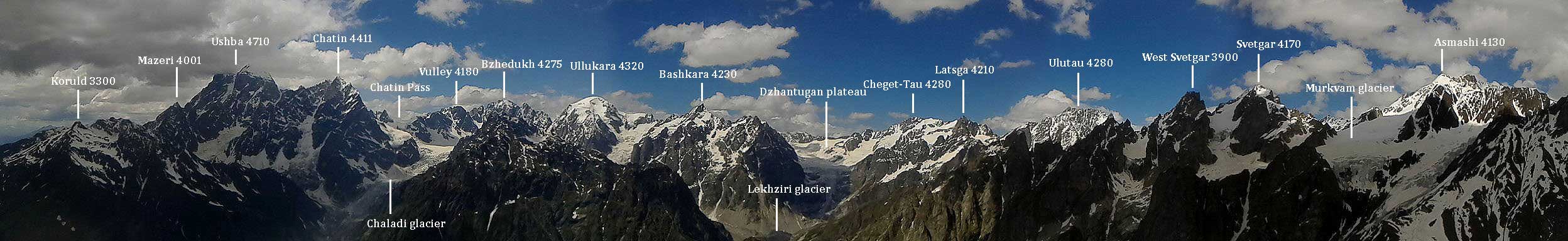
Between Mazeri and Mestia. View from Svaneti Range.
View from Elbrus into Georgia
1. peak Mazeri (4010m)
2 Ushba: North (L) and South (R)
3. Small Ushba (4200m)
4. Kelida Pass (connecting Racha and Lower Svaneti)
5. Chutkharo (3557m) the highest peak of Lechkhumi Range
6. Dadiashi (3550m)
7. Lechkhumi Range
8. Banguriani (3857m) the prominent peak above Mestia
9. Lepitskaro (3450m)
10. Shoda (3607m) of Kedela Range in Racha
11. Tetnuld (4858m)
12. Shkhara (5193m)
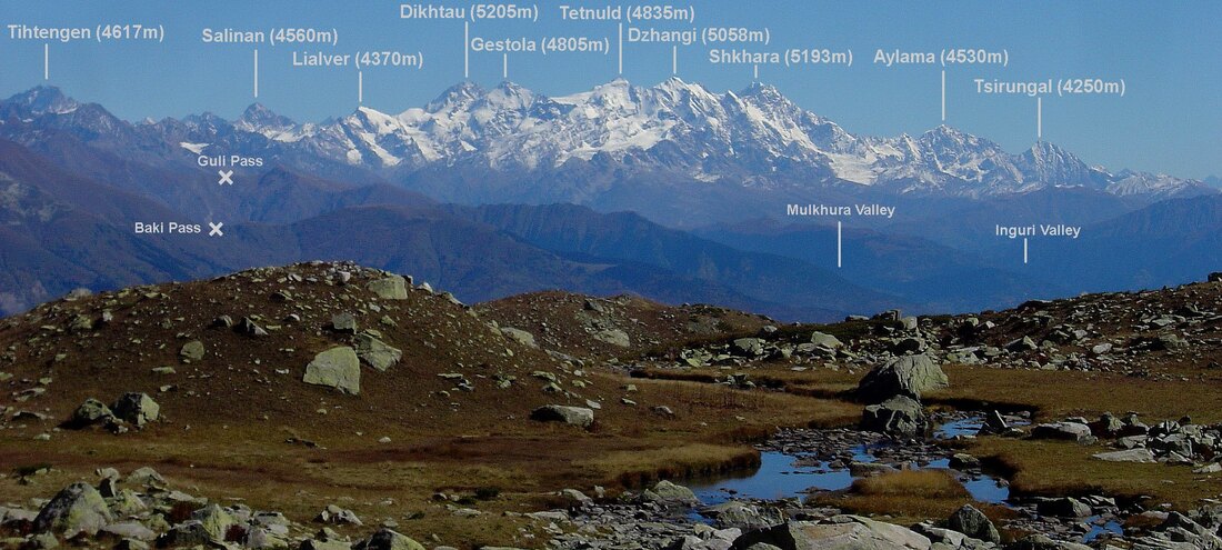
Upper Mulkhura valley and Mulakhi community (looking south-west)
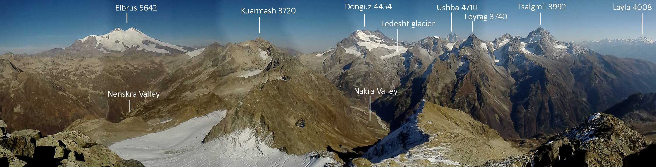
The highest peaks of Svaneti (view from the west)
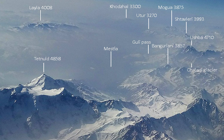
Caucasus in winter as seen from the plane. Svaneti is enveloped in haze.
Icy rampart of the Main Range as seen from Lomismta
1. Tetnuld (4835m)
2. Dzhangi (5058m)
3. Shkhara (5193m)
4. Dikh-Tau (5210m)
5. Mizhirgi (5025m)
6. Aylama (4560m)
7. Koshtan-Tau (5145m)
1. Tetnuld (4835m)
2. Dzhangi (5058m)
3. Shkhara (5193m)
4. Dikh-Tau (5210m)
5. Mizhirgi (5025m)
6. Aylama (4560m)
7. Koshtan-Tau (5145m)
Flying above the Main Caucasus Range in spring
1. Mestia
2. Mt.Ushba (4700m)
3. Adishi
4. Ckhunderi Pass
5. Ushguli
6. Lentekhi (Lower Svaneti)
7. Mt.Shkhara (5193m)
8. Mt.Tetnuld (4835m)
9. Mt.Layla (4008m)
10. Ipari
11. Utviri Pass (Nenskra to Nakra)
12. Guli Pass
13. Latpari Pass (from Upper to Lower Svaneti)
14. Zhabeshi
1. Mestia
2. Mt.Ushba (4700m)
3. Adishi
4. Ckhunderi Pass
5. Ushguli
6. Lentekhi (Lower Svaneti)
7. Mt.Shkhara (5193m)
8. Mt.Tetnuld (4835m)
9. Mt.Layla (4008m)
10. Ipari
11. Utviri Pass (Nenskra to Nakra)
12. Guli Pass
13. Latpari Pass (from Upper to Lower Svaneti)
14. Zhabeshi
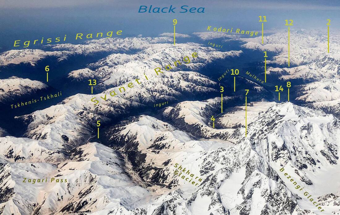
Bakild Range (in the feoreground) and glaciated peaks of Svaneti Range
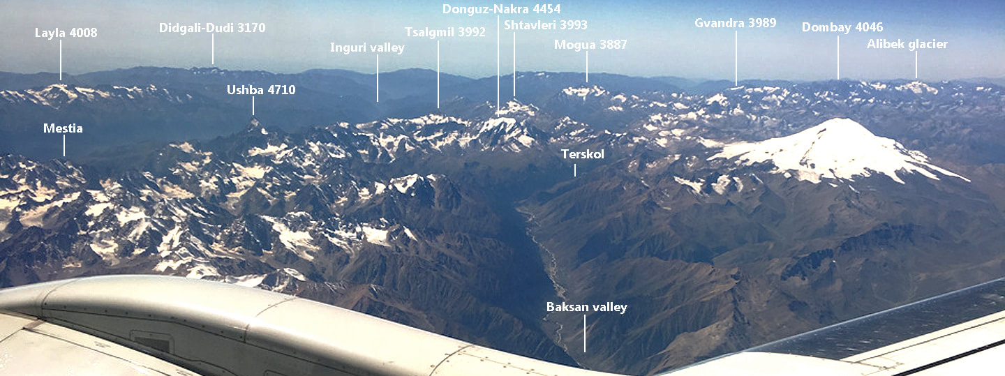
The western part of the Central Caucasus and the Western Caucasus (Dombay is its highest mountain) in the distance. Elbrus and Mogua (3887m) are between the two.
View from Latraldash (3370m) north and north-west
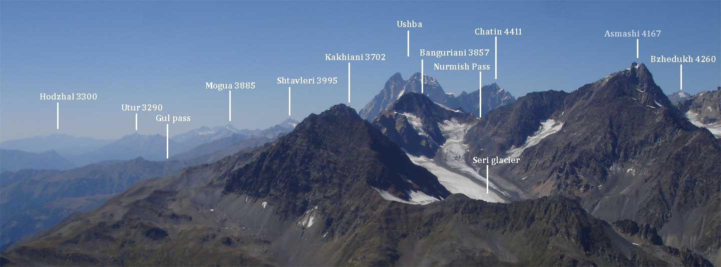
View from 3460m in Shtavleri Range (north, north-east, east)
Looking east from Donguzorun (4454m)
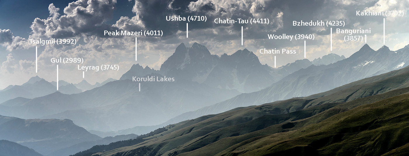
View from 3670m (west)
View west from Chkhundieri pass